# Layers
If the pointcloud is in a coordiante system a layer of a cadastral map and roads can be displayed.
The layers can only be displayed in top view which can be activated by pressing the top view icon.
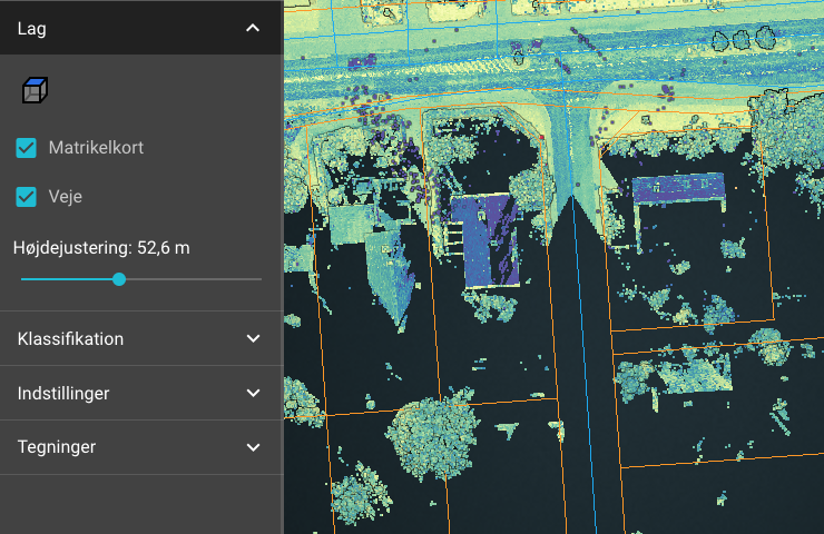
# cadastral map
When the cadastral map is activated, a section of the current cadastral map is retrieved and displayed together with the pointcloud. The layer is shown with orange lines.
# Roads
When roads are activated, a section of the surrounding roads is retrieved together with the pointcloud. The layer is shown with blue lines.
# Elevation Offset
The layers can be adjusted up and down in height to suit the current view of the pointcloud. It may be necessary to change the camera projection to orthographic to see the layers correctly in relation to the pointcloud.
← Clips Classification →